
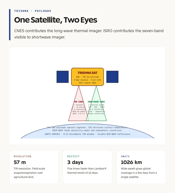
ISRO and CNES Collaborate on TRISHNA Earth Observation Satellite
| Category | Details |
|---|---|
| Mission Name | Thermal Infra-Red Imaging Satellite for High-resolution Natural Resource Assessment (TRISHNA) |
| Developed By | ISRO (India) and CNES (France) |
| Launch Site | Sriharikota, India |
| Objective | Study surface temperature, evapotranspiration, vegetation status, and water stress |
| Applications | Agriculture monitoring, water resource management, climate studies |
| Key Objectives | Monitoring water stress, urban heat island effect, glacier dynamics, atmospheric parameters |
| Instruments | 1. Thermal Infrared (TIR) Instrument (CNES), 2. Visible-Near Infrared-SWIR Instrument (ISRO) |
| Orbit | Sun-synchronous orbit, 761 km altitude |
| Spatial Resolution | 57 meters (land/coast), 1 kilometer (ocean/polar zones) |
| Design Life | 5 years |
| Key Contributions | Supports GEOGLAM, UN Sustainable Development Goals, Global Water Watch |
| Essential Variables | Essential Agricultural Variables (EAVs), Essential Climate Variables (ECVs) |
| Equator-Crossing Time | 12:30 noon |