
GAGAN: India's Indigenous Satellite-Based Augmentation System
| Topic | Details |
|---|---|
| Name | GAGAN (GPS Aided GEO Augmented Navigation) |
| Developed By | Indian Space Research Organisation (ISRO) and Airports Authority of India (AAI) |
| Purpose | India's indigenous Satellite-Based Augmentation System (SBAS) to enhance GPS accuracy, improving aircraft navigation safety and precision. |
| Key Features | Enhances GPS signals by providing real-time corrections and integrity information, reducing navigation errors, and enabling satellite-based precision landing. |
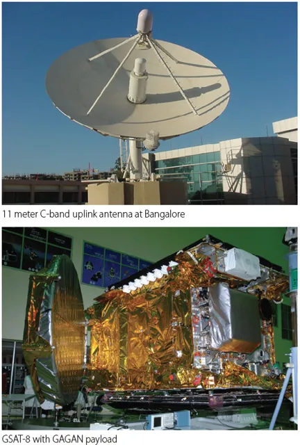
| Components | - 15 Indian Reference Stations (INRES)- 2 Indian Master Control Centres (INMCC)- 3 Indian Land Uplink Stations (INLUS)- 3 Geostationary Satellites: GSAT-8, GSAT-10, GSAT-15 |
| Major Milestone | India's first satellite-based landing using GAGAN conducted by Directorate General of Civil Aviation (DGCA) in June 2026. |